Changed up the back round and header photos to get me a little more in tune with the upcoming "hard water" season. We've had snow a few times this November and so far nothing has stayed. It certainly looks like it won't happen this coming week either, forecast for tomorrow is for 14C and thundershowers and to stay above 0C most of the week! Maybe have time for a last paddle before I start prepping the winter toboggan and hot tent gear!
Plans are underway for the 13th annual Deep Freeze camping trip in February, new participants are always welcome. Here's the blurb from the Canadian Canoe Routes forums. You can check the winter forum for further information as we get closer to February: myccr Deep Freeze - forum topic
Every winter since 2002 a group of enthusiasts has been getting together
in February somewhere north of Sudbury and having a good time indulging
in one of our favourite pastimes – sleeping in the cold!
This
coming February is the 13th year of this get together and this is an
open invitation to anyone who thinks they might like to join in on the
fun. The first “gathering” was held on the Vermillion River north of
Sudbury with 8 participants. Beginning in 2003 we began using the “Budd
Car” rail service from Sudbury to access the backcountry north of
Cartier, Ontario in the Spanish River area. The 2nd year saw 20
participants in total and in subsequent years the average has been about
30 - 35 attendees yearly with a high of 45 one year. It’s a diverse
group with folks coming and going depending on the year but we’ve had
attendees from as far a field as Colorado, Tony (our honorary Canuck)
and his family from New York state and a couple of Brits who were doing a
work placement in Ontario one year!
This year there is a change to the location and means of access for Deep Freeze.
The Budd Car service has become increasingly unreliable, particularly
during the winter months. A few years ago (2011) it didn’t run at all
during the week of Deep Freeze and the group split with some heading
north of Sudbury and some to Killarney Provincial Park. Last year the
train didn’t run on the Tuesday/Wednesday and consequently 10 or so
folks didn’t make it in (ended up in Killarney again!) and there were
folks who needed to get out on the Wednesday and had to hike 12 km down
the tracks to a road for pickup – not a good thing all round!
So,
this year the group will be headed north of Sudbury on Hwy 144 to an
area just south of Halfway Provincial Park. There is an area to park
vehicles off the highway and the camp area is about a 1 kilometer
hike/pull in from the highway across a small lake and then a portage
into the camp lake – Sideburn Lake. This is the same area the group used
a few years ago when we had trouble with the train (2011). A campsite
location was scouted out this fall and there is a large flat bench on
one shoreline with plenty of camping room.
WHEN: February 15 - 23/ 2014 (Sat – Sun, 9 days)
WHERE: Sideburn Lake
HOW: vehicle access from Hwy 144 north of Sudbury, Ont.
WHO: Interested? Join us!!
Sideburn
Lake is northwest of Sudbury, west of Highway 144 just south of the
Halfway Provincial Park southern boundary. The following link is to a
map of the area at 1:50000 scale. The 1:50000 topographic sheet is -
Pogamasing, 41-I/13.
topo of area
https://picasaweb.google.com/lh/photo/v5G4Fj7ilMD8IGvmQ-Pd2dMTjNZETYmyPJy0liipFm0?feat=directlink
google earth
https://picasaweb.google.com/lh/photo/L ... directlink
photo of campsite area
https://picasaweb.google.com/lh/photo/f ... directlink
Anyone
interested in this trip doesn’t necessarily have to commit to the full 9
days and in fact many folks have attended for a portion of the time
only. You can alter or shorten your dates of both arrival and departure
according to whatever works for you!
The parking area shown on
the Google photo is located 17.9 km north of the Cartier turnoff on Hwy
144 or 1 km north of the Onaping Lake Road on the west side of the
highway. It’s approx. an hours drive from Sudbury. The plan would be for
folks to meet there at approx. 10:00 am on the 15th and head into
Sideburn Lk. The parking area will be checked the previous weekend and
arrangements made to plow it if necessary. Folks would be expected to
chip in for the costs of plowing if required. (pit was accessible
without plowing in 2011)
This is a relaxed base camp style winter
camping trip. There is lots of opportunity for hiking, ice fishing,
socializing, camp chores etc. This area also lends itself to some nice
cross-country skiing on connected lakes and trails in the area. All
participants are responsible for their own arrangements; this is your
trip if you choose to take it. Many will be there and folks are more
than welcome to come. Bring your gear, be prepared and plan for it
accordingly.
The following link will take you to trip reports from past Deep Freeze trips in the area - missing the 2012 trip, we did go!
http://canoedog-ca.blogspot.ca/p/winter-trips.html
Cheers, hope to see you there!
Saturday, 16 November 2013

Saturday, 19 October 2013
Planning
Someone asked me the other day how I planned the canoe trips I've go on. They remarked that it seemed like I got myself pretty far off the beaten path and just where did the ideas come from. I use several different resources when planning a trip some are online such as the Canadian Canoe Routes website, http://myccr.com/, peruse the routes section or the forums for a wealth of information and the Ottertooth site, http://ottertooth.com, which has some excellent interactive maps for the Temagami Canoe area.There are route guides such as the Kevin Callan books or my favourite the Hap Wilson Temagami guide, mostly because I spend much of my time canoeing in the Temagami area.
However my favourite is to use the 2 large Temagami area maps I have. They are both a detailed depiction of the routes in the Temagami area.
One is the Craig Macdonald map that shows Temagami as it was in 1900. Craig Macdonald is an ethno-geographer, Cree-Ojibwa place-name linguist and trails expert who spent 27 years doing research in the area. He interviewed over 200 Anishinabai elders and traveled over 1,000 miles in the backcountry exploring the nastawgan and methods of travel on them. Craig estimates that the nastawgan have been in use for over a thousand years. Temagami Nastawgan Map.
The other is the Friends of Temagami Adventure Planning map. For the past two decades, the Friends of Temagami has been documenting, restoring and promoting lost, forgotten and underused canoe routes in Temagami. This map is the result of a comprehensive review of existing information coupled with on-the-ground explorations. Temagami Planning Map.
It's neat to trace routes out on the Nastawgan map and then the Adventure Planning Map, you quickly realize that the routes have been in constant use for a long time. I have used the nastawgan map to go looking for older routes that have fallen into disuse over the years such as the Marjorie Lake route which has been remapped and the portages re-established, putting the route back into use. Marjorie Lake Route.
I have the maps mounted on a wall and it's the first resource I turn to when I get the itch to get out canoeing again. I use it for the general layout of the route etc and then start researching the other resources mentioned for further information. Anyway, it's getting close to winter these days andI've now turned to winter camping trip planning - more maps!

Monday, 14 October 2013
Deep Freeze 2011 - Smokefox Lake
 |
| Smokefox Lake |
The plans for the 10th annual were settled upon and the
Nitro creek area was again our destination. The group all showed up at the
Sudbury station early Saturday morning only to find that the train was
cancelled! What to do? The group discussed options and plans evolved. One group
(9) consisting of the fathers and kids decided that the intermittent train availability wasn’t acceptable and
opted for heading to Killarney Provincial Park to camp for the week. The rest
of the group (23) decided to head north on Hwy 144 and strike out across
country via some lakes and trails to the Nitro Creek campsite and then use the Budd Car to get out
later in the week. Vehicles were left at
the Cartier train station in anticipation of the plan coming to fruition.
We headed north and headed west for Smokefox Lake for the
first night. We crossed the first pothole from the highway, busted a trail into
Sideburn Lake and headed for Smokefox. We found a trapper’s portage trail cleared
into Smokefox and we all found a place to setup for the evening. The plan was
to break a trail into Nitro creek the next day and take some of the heavier
supplies across as a group effort. Well, that worked and we cleared a trail
about ¾ of the way and stashed some supplies. Some of the group had planned on
attending on the Tuesday train and we found out through some satellite phone
messaging that the train was cancelled again due to mechanical problems. It was
decided that we would just stay at Smokefox Lake for the week, which turned out
to be a good call as the train didn’t run at all that week!
The Tuesday folks were all contacted and headed into
Smokefox and we carried on with on normal deep freeze activities of hiking, skiing,
ice fishing and socializing etc.
A celebratory party (with fireworks) in honour of 10 years
of “freezing” was held along with the “Dawg House’s” annual wine and cheese on
another evening.
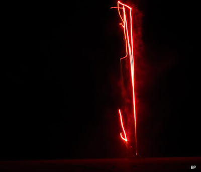

All in all, another great trip with a great bunch of fellow
campers. We planned to again try using the Budd Car the following year so that
the families could also attend once again. It’s always great to have the kids
along learning new skills and helping to keep us all younger!
Tuesday, 17 September 2013
Oh well, s... happens!
Sometimes the best laid plans don't always work out like you envisioned them. I left for a solo trip with some forecasted inclement weather later in the day - rain and winds. Having tripped for many years I've developed a routine and set of gear that allows me to handle just about anything that I may encounter along the way. I did do something a bit different for this trip in using a 2 part pack system (clip together to portage, separate for packing fore and aft in the canoe) that I have, rather than my usual canoe pack and small barrel. With some judicious meal planning and dehydration prep, tight portion control and ruthless winnowing of nice to have stuff, I managed to pack everything for an 8 day trip in the 2 bags using a 20 litre olive barrel for the food - game on!!
Jan dropped me off in overcast conditions and I quickly headed off. Well the weather turned out to be somewhat more severe than forecasted and over the course of the next 5 hours I was thoroughly soaked to the core in spite of full rain gear and the wind switched to out of the north, precipitating a sharp temperature decrease. It was raining so hard that I needed to stop twice in a little over an hour's time to drain about an inch of water out of the canoe. Needless to say, my pack system was sodden and a fair bit heavier than when I started out.
I stopped earlier and one lake sooner to get under cover and change into dry clothing etc. Set up the tarp, gathered a bunch of small wet wood, got my twig stove going and brewed a welcome pot of tea and then a hearty pasta based supper. The rain petered out around 6:30 pm and I got about setting up my hammock for the evening. This is when I discovered that 2 of my dry bags aren't as dry as they used to be! I always pack the essentials in dry bags (sleeping bag/mattress, clothes, hammock etc) which in turn are packed in an Ostrom dry bag pack liner which has never failed despite enduring monsoonal rains or the occasional dump in a rapid etc on trips. However, since I was using my smaller 2 part system (each bag is about 35 litres) I used separate dry bags for different things this time without a pack liner. I found a fairly large wet spot on my down sleeping bag and the hammock was also damp in it's dry bag. Not much I could do about it other than make the best of it for the night and dry out things the next day, a bit of a pain in the butt but easily remedied.
The other foul up revolved around my sat phone. I am out in the bush camping, canoeing and hiking upwards of 40 - 50 nights/year in fairly remote areas and often solo. Jan worries about me injuring myself etc and we've developed a system using my sat phone to allow her to track my progress and ease her concerns. I am much more conservative when tripping alone than I might be with someone else but as we all know, shit happens, dump the canoe and lose gear, slip and fall injuring myself etc. I use an Inmarsat phone that has a built in GPS that allows me to send a location daily via a text message in the evening and Jan follows my progress on a map and all is well. So, the thing about using technology is it's great when it works and not so great when it doesn't. I did my usual routine and fired up the phone, locked on the system and the phone generated my GPS location and I hit send - sorry, network failure, message not delivered, sent to draft! OK, tried it again, same result, tried both a text and email message which is our main method of communication rather than the considerably more expensive voice option, with the same result. So, dial up and phone home which is when I got the message from the provider that my account had expired - Doh! It turned out it was not the end of September expiration date on my card as I thought but the beginning of the month. Oops, no remedy for this one as I use prepaid minutes and if you don't roll them over with a renewal before expiration you get to start over.
So, I'd gone from cold and wet to dry and warm to a wet sleeping system with the temps headed for freezing and a partner at home wondering why I hadn't checked in, life is good usually but sometimes the odd complication creeps in! Jan and I have an understanding should something go south on one of my trips if I haven't checked in, she will wait till for 2 missed evening communications and then call out the dogs as the deal is at that point something has probably happened. I awoke to a hard frost, and a stiff north wind but no rain and the promise of sun later in the morning. My sleeping bag was considerably wetter from my generated body heat and sweat and in a perfect world I would have just laid over for the day and dried out before continuing as except, for the phone, all was fine. I packed up and headed back south to a cottage lake hoping to find someone with some sort of phone service to alert Jan to the situation before she the set the dogs loose! If this option didn't work I would head down to the Kukagami Lake road and walk over to Sportsman Lodge where there is a phone. Long story short I managed to find a very generous couple on Matagamasi Lake with an internet phone system late in the afternoon. I phoned Jan and she picked me up a couple hours later.
Ah well, live and learn. I'm lucky to be able to indulge in my outdoor interests all year long and the sat phone has become an integral part allowing everyone a level of comfort and safety while I'm out there pursuing my passion for the outdoors. I checked my providers website this morning and low and behold they now are offering an automatic recharge option on the prepaid cards. Now that is a great Sid option as I'll never turn that sucker on again and get the "your account has expired" message again!! Now to unpack and dry everything out while I wait for my account to be recharged so I can finish what I started :-)
Post script: I spent an enjoyable few hours chatting with the older couple who lent me their phone. We discussed the history of the area (Chiniguchi area, Matagamasi Lake in particular), remote phone service - they live off the grid and our kids. Turns out one of their sons married the daughter of folks we knew when we lived in Thunder Bay in the early 1980's. It's a small world sometimes, after all what are the chances of anyone canoeing up to a remote cottage and finding out that you have some mutual acquaintances!
Jan dropped me off in overcast conditions and I quickly headed off. Well the weather turned out to be somewhat more severe than forecasted and over the course of the next 5 hours I was thoroughly soaked to the core in spite of full rain gear and the wind switched to out of the north, precipitating a sharp temperature decrease. It was raining so hard that I needed to stop twice in a little over an hour's time to drain about an inch of water out of the canoe. Needless to say, my pack system was sodden and a fair bit heavier than when I started out.
 |
| Rain on Matagamasi Lk. |
I stopped earlier and one lake sooner to get under cover and change into dry clothing etc. Set up the tarp, gathered a bunch of small wet wood, got my twig stove going and brewed a welcome pot of tea and then a hearty pasta based supper. The rain petered out around 6:30 pm and I got about setting up my hammock for the evening. This is when I discovered that 2 of my dry bags aren't as dry as they used to be! I always pack the essentials in dry bags (sleeping bag/mattress, clothes, hammock etc) which in turn are packed in an Ostrom dry bag pack liner which has never failed despite enduring monsoonal rains or the occasional dump in a rapid etc on trips. However, since I was using my smaller 2 part system (each bag is about 35 litres) I used separate dry bags for different things this time without a pack liner. I found a fairly large wet spot on my down sleeping bag and the hammock was also damp in it's dry bag. Not much I could do about it other than make the best of it for the night and dry out things the next day, a bit of a pain in the butt but easily remedied.
 |
| Under cover and beginning to dry out! |
The other foul up revolved around my sat phone. I am out in the bush camping, canoeing and hiking upwards of 40 - 50 nights/year in fairly remote areas and often solo. Jan worries about me injuring myself etc and we've developed a system using my sat phone to allow her to track my progress and ease her concerns. I am much more conservative when tripping alone than I might be with someone else but as we all know, shit happens, dump the canoe and lose gear, slip and fall injuring myself etc. I use an Inmarsat phone that has a built in GPS that allows me to send a location daily via a text message in the evening and Jan follows my progress on a map and all is well. So, the thing about using technology is it's great when it works and not so great when it doesn't. I did my usual routine and fired up the phone, locked on the system and the phone generated my GPS location and I hit send - sorry, network failure, message not delivered, sent to draft! OK, tried it again, same result, tried both a text and email message which is our main method of communication rather than the considerably more expensive voice option, with the same result. So, dial up and phone home which is when I got the message from the provider that my account had expired - Doh! It turned out it was not the end of September expiration date on my card as I thought but the beginning of the month. Oops, no remedy for this one as I use prepaid minutes and if you don't roll them over with a renewal before expiration you get to start over.
So, I'd gone from cold and wet to dry and warm to a wet sleeping system with the temps headed for freezing and a partner at home wondering why I hadn't checked in, life is good usually but sometimes the odd complication creeps in! Jan and I have an understanding should something go south on one of my trips if I haven't checked in, she will wait till for 2 missed evening communications and then call out the dogs as the deal is at that point something has probably happened. I awoke to a hard frost, and a stiff north wind but no rain and the promise of sun later in the morning. My sleeping bag was considerably wetter from my generated body heat and sweat and in a perfect world I would have just laid over for the day and dried out before continuing as except, for the phone, all was fine. I packed up and headed back south to a cottage lake hoping to find someone with some sort of phone service to alert Jan to the situation before she the set the dogs loose! If this option didn't work I would head down to the Kukagami Lake road and walk over to Sportsman Lodge where there is a phone. Long story short I managed to find a very generous couple on Matagamasi Lake with an internet phone system late in the afternoon. I phoned Jan and she picked me up a couple hours later.
Ah well, live and learn. I'm lucky to be able to indulge in my outdoor interests all year long and the sat phone has become an integral part allowing everyone a level of comfort and safety while I'm out there pursuing my passion for the outdoors. I checked my providers website this morning and low and behold they now are offering an automatic recharge option on the prepaid cards. Now that is a great Sid option as I'll never turn that sucker on again and get the "your account has expired" message again!! Now to unpack and dry everything out while I wait for my account to be recharged so I can finish what I started :-)
Post script: I spent an enjoyable few hours chatting with the older couple who lent me their phone. We discussed the history of the area (Chiniguchi area, Matagamasi Lake in particular), remote phone service - they live off the grid and our kids. Turns out one of their sons married the daughter of folks we knew when we lived in Thunder Bay in the early 1980's. It's a small world sometimes, after all what are the chances of anyone canoeing up to a remote cottage and finding out that you have some mutual acquaintances!
Friday, 13 September 2013
Getting Ready!
Haven't been out on a solo trip yet this year, however that will soon change! Picked up my solo boat this morning from storage, purchased a 3 night permit for the Sturgeon River PP and will have my sweetie drop me off this Sunday morning at the Crystal Portage on Matagamasi Lake. I'll head north through Wolf, Chiniguichi, Dougherty, Stouffer Lakes and then use the "Backdoor Route" to Kettle Falls on the Sturgeon R. Then I'll run the river south for a few days to the link at Kelly's Crossing to Maskinonge Lake. I'll use the route through Ozhway, Gamagowong, Gagnon and Gawasi Lakes as the 3.5 km portage using Kelly's Crossing just isn't on for me!! Once on Maskinonge I'll either head back to the the drop off/pick up point via the Donald Creek/Donald Lake route or north through Rice, Edna and Karl Lks to Matagamasi Lk.
A fall trip, no bugs, low number of paddlers in the area and a full moon next week - what's not to like about that?
A fall trip, no bugs, low number of paddlers in the area and a full moon next week - what's not to like about that?
Thursday, 25 July 2013
Kayaking Lake Temagami - July 2013
It had been a bit of a hectic year so far and we hadn't been able to get out on a canoe or kayak trip yet, what with southern trips, work and life all conspiring against us! Time became available in early July, the dog sitter was booked and we headed out for a few days to kayak the southern end of Lake Temagami.
Although Lk. Temagami has a fair number of camps and lodges etc, they are all situated on the islands and there is a huge amount of shoreline and back bays etc to explore. Being a large lake it can get fairly wind blown quickly, lending itself to exploration with kayaks rather canoes. We packed up our gear, dropped the dog off and 2 hours later we were unloading our gear and packing our kayaks at the central hub of the lake at the end of the mine road south of the village of Temagami. We headed south aiming for the southeast corner of the lake with a quick stop at the trailhead of the High Rock trail for lunch.
We then headed south poking along in the 30+ degree heat, good thing there was a bit of a breeze to help cool us. We eventually reached an nice campsite and set up for the next couple days. The weather was stinking hot and we relaxed in the shade, swam and read books. As it was so hot we decided to just stay in one spot for the duration.
It was a much needed relaxing trip and the beauty of Lake Temagami always refreshes us whenever we explore it's many nooks and crannies along it's pine covered shores. We'll return, as it will take us a long time to explore it all!
Although Lk. Temagami has a fair number of camps and lodges etc, they are all situated on the islands and there is a huge amount of shoreline and back bays etc to explore. Being a large lake it can get fairly wind blown quickly, lending itself to exploration with kayaks rather canoes. We packed up our gear, dropped the dog off and 2 hours later we were unloading our gear and packing our kayaks at the central hub of the lake at the end of the mine road south of the village of Temagami. We headed south aiming for the southeast corner of the lake with a quick stop at the trailhead of the High Rock trail for lunch.
 |
| Jan - High Rock trailhead dock |
We then headed south poking along in the 30+ degree heat, good thing there was a bit of a breeze to help cool us. We eventually reached an nice campsite and set up for the next couple days. The weather was stinking hot and we relaxed in the shade, swam and read books. As it was so hot we decided to just stay in one spot for the duration.
 | |||
| funky skyline |
 | |||
| Blue Flag and Cedar |
 |
| Sid 'yak - Current Designs Solstice GT |
 |
| Jan 'yak - Current Designs Vision 150 |
 |
| "evening falls" |
 |
| sunset with moonrise |
 |
| bug net & chairs - don't leave home without them! |
It was a much needed relaxing trip and the beauty of Lake Temagami always refreshes us whenever we explore it's many nooks and crannies along it's pine covered shores. We'll return, as it will take us a long time to explore it all!
Monday, 15 July 2013
Helinox Camp Chair
Purchased a couple of these chairs for canoeing and kayaking trips this past spring. These chairs are definitely a winner. They pack up small, about 12" x 5" x 5" and weigh about 2 lbs! We purchased ours at SAIL when they were on sale ;-) for 20% off list price of $89. Yep, they're expensive but they are about 4-6 lbs lighter than a normal sling type chair not to mention smaller and they get you off the ground at a comfortable height that still allows you to sit and tend a stove etc at camp.
One problem is soft or wet ground. The feet are quite small and tend to sink into the ground throwing you off balance etc. I purchased some tennis balls, slit them about 1 1/2" and place them over the feet - problem solved and they also fit into the chair's carrying bag :-)
Construction looks to be excellent, I've used mine now for about 3 weeks in the bush and it is showing no signs of wear or failure especially in the area where the sling fits over the poles. Sure feels good to be off the ground and comfortable at the end of a long day of canoeing and portaging!

Cheers!
Friday, 24 May 2013
Solace Lake - Pilgrim Creek - Yorston River Loop, May 2013
Planning commenced sometime in early March or
so and we decided on a trip in the northwest corner of Temagami. We planned to
canoe down the Sturgeon R. from the Gervais crossing and cross over into the
Solace Waterway Park, and then head south down Pilgrim Ck., a little travelled
route that is more of a spring run. Once through Pilgrim we would crossover to
Yorston Lk. and then head north again using the upper Yorston R. watershed back
to the Solace Waterway Park. We would head west and then north through Solace
Lk. to Reagan and Hamlow lakes back to our starting point on the Sturgeon R.
Day 1
We left Sudbury headed for the put in under
overcast and cool skies. It’s about a 2-hour drive from my place to the Gervais
crossing and the road is in good shape with the only disturbance just north of
the 1st Wanapitei River bridge, where a logging operation is in progress. We
arrive at the bridge, which is closed to non-logging traffic, and quickly load
the canoe and park the truck well off the road. We push off down river and are
surprised by a large sweeper across the river about a minute downriver.
Fortunately we have time to move to river right and squeeze under/through the
branches without mishap, fellow canoeists beware!
 |
| headed down the Sturgeon River |
The river is much higher than when I travelled
the river last spring at the same time and we
quickly make our way to Paul Lk.
and then Ghoul Lk. for the 1st portage of the day – 1275 metres to a
small pothole before Selkirk Lk. We pass over and after a quick paddle across
the pothole is a 220 m. port to Selkirk Lk. The sun burns through the overcast
conditions and we experience mid to high teen temps and sunny skies for the rest
of the day.
There are 2 possible routes from Selkirk Lk. to
Solace Lk. our eventual destination and we choose the northern route. 3 shorter
portages lead to a 660 m port into the small lake before the 900 m. portage
into Solace Lake. It’s a nice afternoon and we begin to work our way through
the chain and discover a few muscles and joints that haven’t been used very
much over the winter! One nice thing is that there are absolutely no mosquitos
or black flies present! We reach Solace Lake somewhat sorer than when we
started out and we head for the southern most marked campsite on an island near
the east shore of the lake. We set up camp, and enjoy a nice steak dinner and
some colourful skies for the evening.
 |
| evening glow |
Distance portaged – 3250 metres
Day 2
Morning dawned under overcast skies again,
however the forecast promised sunny conditions later in the day. We ate and
packed up and headed south for Solace Ck our route out of Solace Lk. The creek
levels had dropped already and the first 2 sets of rapids forced us out of the
boat and we waded and lined our way down to the first small widening of the
creek.
 |
| Solace Creek |
We decided here to take the marked portages on the Friends of Temagami
planning map over to Apollo Lake. There are anywhere from 6-9 further sets of
rapids along Solace Creek till it joins Pilgrim Ck and we worried that we’d
spend too much time negotiating these obstacles as we were hoping to make it to
Limit Lk for the evening.
The 3 ports to Apollo Lk. total 1100 m. but the
1st port of 800 m. is a bit of a nasty one with a swampy area in the
middle to negotiate and the trails are not readily apparent. This port was most
likely worse at this time due to the recent melt and the swampy sections were
very wet. We managed to find the trail across the swamp but in retrospect we’ll
always wonder what we missed by taking the ports instead of the creek.
Once on Apollo Lk. we headed south and entered
Pilgrim Ck. as the sun again appeared for the rest of the day. From Apollo Lk
to River Lk we encountered about 6-8 C1, swifts and rock lift overs plus a fair
number of log lift overs, wet feet were to become the daily norm! Between River
Lk and Limit Lk the obstacles become a little more serious with some longer
C1/2 rapids and swift areas. We waded what was too shallow to run and did a
fair bit of bump and grind down the rest of the sections we ran. All in all a
pretty fun afternoon but in lower water levels you’d be doing a lot more wading
and lining.
 |
| Pilgrim Creek |
We set up camp on the island at the north end
of Limit Lake and enjoyed a hearty supper in the afternoon and evening sun.
Once camp chores were done a cow and a yearling moose wandered out across the
lake from us feeding along the shoreline. We sat and watched them for close to
an hour before the cow finally sensed we were there and they slowly melted away
into the bush.
 |
| some of the local's |
Distanced portaged – 1100 metres with a fair bit of wading, lining
and lift overs
Day 3
It was a clear and cool night and we awoke to a
hard frost coating everything in the morning. We allowed things to thaw out a
bit, ate and packed and we’re on our way again. There are 3 marked ports south
of Limit Lake around rapids chutes and falls. Well they are marked on the maps
but there is not much indication of them on the ground! We spend some time
figuring a way around the obstacles and portage all 3 of them on river left,
total distance for the 3 ports is probably 5-600 m. of dense brush and rock etc.
to traverse. It made for a longish morning. We did however see a 3rd
moose on the creek between the 2nd and 3rd rapid/falls.
There are some further rapid areas south of the 3 ports but we ran, waded,
lined and lifted over the numerous logs etc. The creek widens and slows
somewhat for a for a distance of 6-7 km. with only the odd tree/log jam across
the creek and 1 rocky C1 till you get to where the creek narrows and
begins it’s quick descent down to the Sturgeon River.
Where the creek narrows there are 2 rather
impressive falls and chutes to portage around before you reach the crossover
portages from the creek to Yorston Lake.
 |
| chute on Lower Pilgrim Creek |
We arrived here fairly late in the
afternoon and after spending some considerable time scouting we managed to
portage our gear around the first set of obstacles on river right. There was
some old blazes etc. present but it’s basically a bush bash around the
falls/chutes. We were tired and a bit sore so we elected to camp for the night
at the end of the 1st carry as the 2nd portion was going
to be even nastier with thicker bush and deadfall etc! We set up camp, ate
supper and watched our local beaver patrol the pool between the drops while
Daniel made a few casts and managed to catch a nice brook trout in the pool.
 |
| campsite on rock face area |
Distance portaged – approx. 800 metres with a fair bit of wading,
lining and lift overs
Day 4
Part of the problem the previous afternoon with
the carry around the 2nd portion of rapids and chute was that the
bush was very thick and once past the chute there was also a major log jam to
get over as well. The combined distance was probably about 300 m. and we were
not looking forward to it at all. However, Daniel suggested scouting river left
across from our makeshift campsite in the morning and found that it was
probably 110 m. around the chute through mostly open cedar whereupon we could
paddle across the creek and carry about 50 m. around the log jam through an
easier section of bush on river right. So, that’s what we did! Funny how a
problem can be thought through when you’re rested and looking at it with fresh
eyes. It’s only about 300 m. further down the creek to the crossover
portages to Yorston Lake. Ottertooth map
We reached Yorston Lake at about 11:15 am
having already portaged close to 3 km before lunch! As we headed north we ran
into the first folks we had seen since leaving. They were camped on an island
and enjoying the long weekend fishing. We continued up Yorston Lk. and stopped
for lunch at the campsite on the north end just before the portage we intended
to take into Seagram Lk. A good lunch, water break and we were off
again, this time up and over the ridge and down a fairly steep incline for 660
m. into Seagram Lk. where we again ran into a party of 4 fishermen in 2 boats.
There had been a large fire through the area in
the late 80’s and as we paddle west and north along the upper Yorston R. we
pass through the regenerating growth crowding the shorelines.
 |
| Upper Yorston River burn area |
There is a
portage at the western end of Seagram Lk. that bypasses the spectacular Seagram
Falls. The portage climbs the hill right along side the river and falls and the
upstream takeout is quite close to the drop – a place to take care. You have to
bypass a couple more, smaller drops before you reach Long Lake. Here we find
some remnant ice and snow on the north-facing cliff at the south end of the
lake.
 |
| Long Lake |
We are headed for Talking Falls and the campsite there for the night. We
track 75m through a small rapid and portage 135 m past a small drop and arrive
at Talking Falls with lots of daylight left to relax and clean up and dry some
gear. A good day, straightforward progression all day long!
Distance portaged/tracking – 4245 metres
Day 5
I awoke at 3:00 am to the sound of rain on my
hammock tarp and was glad that I had placed all my gear except for my boot
socks under cover before retiring. I wasn't worried about my socks, as we had wet
feet during the day since day 1 from all the wading and swampy ports etc. We
had breakfast under the tarp, packed up and headed north aiming to reach Solace
Lk for the night. It was destined to be a long wet day with some tough portages
along the way.
We worked our way up the Yorston R. to Bluesucker
Lk and the start of the Solace waterway park once again. As we’re wet we elect
to wade and track wherever we can and consequently only have 1 small port of
about 150 m till we reach Bluesucker Lk.
 |
| Bluesucker Lake |
We pass to the west shore and the
first portage to Benner Lk. 15 or 20
minute paddling brings us to the port into Rodd Lk. with another 15 minute
paddle to the port into Pilgrim Lk. It’s lunch time, we’re wet and cold so we
stop at the campsite on Pilgrim and set up a tarp. We have a fairly leisurely
lunch and dry ourselves as best we can in preparation for the more onerous
ports to follow.
A quick look at the topographic map for the
area will show you what lays ahead! The 2 portages from Pilgrim to Maggie and
Maggie to Bill lakes all cross over multiple contour lines and are fairly
strenuous to say the least! The weather improves somewhat for the next 5 hours
or so and makes the ports a little more bearable without the rain. Once you
reach Bill Lk. there are 2 shorter portages, which bring you, back to Solace
Lk. We see some folks on the northern campsite island on Solace and spend the
night on the southern most site again. The weather turns again and we manage to
get set up for the evening before the rain starts again and enjoy supper and
coffee under the tarp.
Distance portaged/wading/tracking – 2750 metres
Day 6
Awoke to the sound of rain again on the tarps,
sometimes you win and sometimes you get wet! We eat and pack as it rains off
and on with varying intensity, load the canoe and head north up Solace Lk. We
are using the old Nastawgan route north from Solace to eventually get to Hamlow
Lk. for the last night on our trip. This route was reopened starting in 2003 by
some folks with the Friends of Temagami and by the Keywadin camp. Today the
trails are open and easy to find although it does travel through some rough
country with some good elevation changes along the way! We head into Einar Lk
after saying hello to the canoeists camped on the northern site in Solace Lk.
We quickly pass through into Biscuit Lk. and then into Broadbent Lk. and all
the while it’s raining. The port from Broadbent starts out with a steep climb
out of the lake where it flattens out with a small swampy section at the
Carrying Bar Lk end.
 |
| Carrying Bar Lake |
The portage from Carrying Bar into Tooth Lk.
passes quickly; I just wish the rain would pass. There is a lift over into the
creek between Tooth and Melanson Lk. and we elect to wade and lift over through
the 120 m section at the Melanson Lk end rather that portage along the
shoreline. We quickly head for the portage to Regan and once we are out of the
wind we stop for lunch and wring out our socks once again! Once lunch is done
we head for Regan Lk and head for Hamlow and our evening campsite.
The weather continues to rain off and on and
the wind has picked up also. We use the shorter portage into Hamlow and check
the marked campsite at the old Portelance sawmill site. It is fairly wide open
and covered mainly with birch and poplar trees and with the wind and rain find
it very exposed to the elements. We elect to head across Hamlow and look for a
place to tuck ourselves in out of the wind for the night. We settle on camping
along the portage into Stull Lk on the north shore about 80 m in the bush and
out of most of the wind. It quits raining for a bit allowing us to set up for
the night, gather some wood to cook supper and breakfast with and to relax
after another long wet day!
 |
| tucked into the trees |
Distance portaged/wading/lift overs – 2840 metres
Day 7
Well, we had quite a thunderstorm hit us last
night just as we turned in for the night! However it is not raining when we
wake up and that’s a bonus for a change. We have breakfast and pack
up all our soggy gear, load the canoe and head off across Hamlow for the last
portage of this trip. It is the traditional Nastawgan trail that connects
Hamlow Lk with Stull Ck just before it meets with the Sturgeon River. Last year
the when I was through here I used the Nastawgan to get up to Ishpatina Ridge
and then took Stull Ck back to the Sturgeon, however the water levels were
considerably lower then.
We hit the trail and are launching the canoe
about an hour later for the short run down Stull Ck to the Sturgeon R and the 15-minute
paddle back to my vehicle parked at the bridge at the Gervais Crossing.
 |
| Gervais crossing on the Sturgeon River |
We unload the boat, load the truck, tie on the
canoe and yes, you guessed, it starts to rain again. However, we’re dry and on
our way back to my place in Sudbury for a hot shower, a fitting end to the
trip!
Distance portaged – 1650 metres
This was a fairly ambitious trip through some
of the last roadless, virgin and wild areas of the Temagami Canoe region. The
Pilgrim Creek section of the trip is particularly rough and not travelled much,
which was the reason this particular route appealed to us. You need to be
confident in your bush living and path finding skills in particular if you
travel this portion of the loop we did. All the other areas are more used and
the portages etc. are either marked or easy to locate. We used Hap Wilson’s -
Canoeing, Kayaking and Hiking Temagami guide for information on the routes and
the Pilgrim Ck portion in particular plus the excellent maps produced by Brian
Back on the Ottertooth website.
Tuesday, 7 May 2013
Save Wolf Lake Video
Another excellent video from the Save Wolf Lake organisation
Save Wolf Lake
The group continues to get the word out about the Wolf Lake area northeast of Sudbury, Ontario. Well worth a look and some time to add to their efforts to engage the politicians to provide the area the protection it deserves.
http://savewolflake.org/
Save Wolf Lake
The group continues to get the word out about the Wolf Lake area northeast of Sudbury, Ontario. Well worth a look and some time to add to their efforts to engage the politicians to provide the area the protection it deserves.
http://savewolflake.org/
Sunday, 5 May 2013
Getting ready!
 |
| Busy this week! |
 |
| Burger! |
Monday, 29 April 2013
Soon?
Felt more like spring this past weekend, actually got up to about 22C yesterday! Ice pretty well gone south of the French with the rivers/creeks flowing to the north. However, still a lot of snow and ice to melt north of Sudbury. MNR ice flights show ice still fairly white and tight to the shorelines. The forecast is more favourable as we head into May with the overnight temps staying in the teens - a real snow and ice remover. Hopefully be out mid month for a loop trip through northwest side of the Temagami canoe area - Sturgeon - Solace- Pilgrim - Yorston - Solace - Sturgeon. Better get the dehydrator out!
Monday, 15 April 2013
Spring???
Well, it's been an interesting couple weeks since I last posted. I've been away instructing on the S100 Basic Forest Fire Fighting courses and the weather has been all over the map. The last week was spent in the Ottawa area and we experienced rain, snow, freezing rain - generally it's been a cold wet spring so far. I was watching the ice conditions on the drive home today along Hwy 17 from Ottawa to Sudbury, the creeks and rivers are mostly running but the lakes and ponds are all still covered with white ice and still tight to the shores :-( At this rate we'll be lucky to be on the water by mid May in the Temagami - Sudbury region. Here's hoping for some temperatures in the high teens or low twenties with some warm rain with lots of sunshine for the next few weeks. We're going to need it to kick start paddling season!
Tuesday, 26 March 2013
Spring?
I'm starting to feel it now as the days lengthen and warm to above freezing in the afternoons. Spring will be later than last year but planning is underway for a new paddling season. Thought I'd change the blog header photo to celebrate the coming open water season! Cheers.
Monday, 4 March 2013
Deep Freeze 2013 - Nitro Creek
Well another year had passed and the annual gathering of the
winter camping enthusiasts known as the “freezers” had gathered for the 12th
annual “Deep Freeze” north of Sudbury, Ontario. Once again we would be
travelling north on the Budd Car to the Nitro Creek drainage area for 8
nights/9 days of outdoor living in mid February. Saturday dawned clear and cold as we gathered at the Sudbury
train station to pack sleds and toboggans in anticipation of loading the
baggage car and departing on another adventure.
As usual, the Budd Car was somewhat delayed (about an hour)
in arriving to load. There was the usual assortment of passengers heading to
various destinations along the line, our group of 23 plus another group of 9
winter snow trekkers heading up to the Missanaibi area to begin a 100+
kilometer trek across lakes and along the Missanaibi River to the main CN line
where they would be picked up by Via’s transcontinental train for the ride back
to Sudbury. This group was a commercial trip lead by the owners of Lure Of the North, a local Sudbury company.You can access photos of their trip on the Lure of the North's Facebook Page.
 |
| Toboggans and sleds in the baggage car |
 |
| Unloading at Nitro creek |
 |
| Preparing the interior of the "Lounge" |
 | ||||
| The "Smokey Lounge - Bar and Grill" |
Day 2 is traditionally spent tidying up the camp area and
getting in a substantial wood supply for the week.
 |
| A nice stack of firewood! |
The water hole, which had
sucked a couple folks in for a wet foot was rearranged with a log bridge to
span the creek and ensuring no further mishaps. Once chores were done a few
folks passed the crisp afternoon with a hike to one of the many small lakes in
the area.
As is usual the rest of daytime activities for the week
consist of hiking, ice fishing, socializing, bird watching, reading, naps –
whatever!
 |
| Nice fish Bob! |
 |
| Sorry, Bob's is bigger! |
It is a no stress, relaxed trip for sure. Several of our attendees are starting to get
along in age and one new activity involved one participant’s daily blood
pressure check! This in turn led to everyone having a turn one morning, I’m
happy to report that everyone at least had a pulse!
 |
| Still working, guess I'll go fishing! |
Things were in full swing when we found out on Tuesday
shortly after noon that the Budd Car was down with compressor problems and
wouldn’t be running for 2 days. This presented 2 problems – there was a group
of approx. 13 folks who had planned on coming in Tuesday and heading home on
Sunday and we had 4 people in camp who were supposed to leave on Wednesday! 12
of the folks decided to head for Killarney Provincial Park and the 13th
was to try to get in on the Thursday train. That still left the 4 outbound
folks and the dilemma of what to do. The Nitro area is about 11 km up the track
from the nearest road access or you can hike 10km across country to the highway,
either option is not that appealing especially when there is deep snow, slush
on the lakes and you’re pulling your gear on a toboggan or sled. In the end
they opted to walk the tracks to Benny and were picked up by Joe’s wife Carol
and dropped off at their vehicles at the train station. Oh yeah, we kept their
gear and would bring it out for them later in the week, sparing them the
necessity of dragging their gear down the tracks. Sure is handy having a sat
phone available to sort out these kinds of problems!
 |
| Wednesday departure - hiking out to Benny |
 |
| around the fire |
 |
| Al and Georgi |
Friday dawned with more snow flurries and with another group
preparing to leave. They spent the day packing and cleaning up their tent areas
and we all hiked out to the tracks to see them off. However, it was cold wind blowing and
snowing and the train was late so we said our goodbyes and headed back to our
tents and some supper, while they huddled around a fire inside the bush line
waiting.... The train finally showed about 2 hours late and quickly loaded them, gave a
blast on the horn and then there were only 9 of us left till Sunday.
We spent the next day fishing and hiking and Al played again
Saturday night but inside a nice warm tent for a change. We had a leisurely
breakfast Sunday and slowly packed up camp aiming to be out at the tracks for
4:00 pm for a 4:30 pick-up, it always helps to be positive about the Budd Car.
We waited and the train was only about 40 minutes late for us and with minimal
freight train activity we arrived back in Sudbury in daylight for change.
Well all things considered it was another good trip that could only have been improved with the Budd Car running as scheduled. We certainly missed the 12 folks who didn't make it in to camp on the Tuesday, although they did have a good trip into Killarney. The folks who walked out on Wednesday sure wished the Budd had been running! It's unfortunate that VIA hasn't seen fit to upgrade the Budd Car coaches and baggage cars to ensure a more reliable service especially in the winter months. Sadly, this group will probably look to an alternative area(s) to carry on the Deep Freeze tradition where we can access the camp via road etc and not be dependent on a sadly deteriorating service. Stayed tuned for information regarding the 13th annual Deep freeze in February 2014 sometime next fall.
Photo Credits: SB - S. Bredin, BP - B. Poort, BR - B. Richardson
SLIDESHOW
 |
| The"Freezers" minus Daniel, Rob and the two Kevins! |
 |
| Poles stored for next time |
 | ||||
| Headed home in the baggage car |
Photo Credits: SB - S. Bredin, BP - B. Poort, BR - B. Richardson
SLIDESHOW
Subscribe to:
Posts (Atom)